1000 Years of the Valley: Rediscovering Ajmer Through Maps
Adaptiv Admin
Jun 27, 2026 · 4 min read
From 27 May to 5 July, Project Bhaskar presents 1000 Years of the Valley, a scenographic exhibition that traces the evolution of Ajmer over the past millennium through maps, archival material, paintings, and data visualisations.
When we first began planning this project, the idea was straightforward. We put out a community call asking residents to share old photographs, postcards, documents, and family archives that captured everyday life in Ajmer.
As the responses came in, another question began to emerge.
Many people remembered fragments of the city's past, but very few could explain how Ajmer itself had evolved. How did a city founded because of its geography become an imperial centre? Why did it briefly become the capital of its own state after Independence? And how did it eventually come to be viewed as a Tier-3 city within Rajasthan?
Before telling the stories of the people who lived here, we realised we first needed to tell the story of the city itself.
That became the starting point for 1000 Years of the Valley.
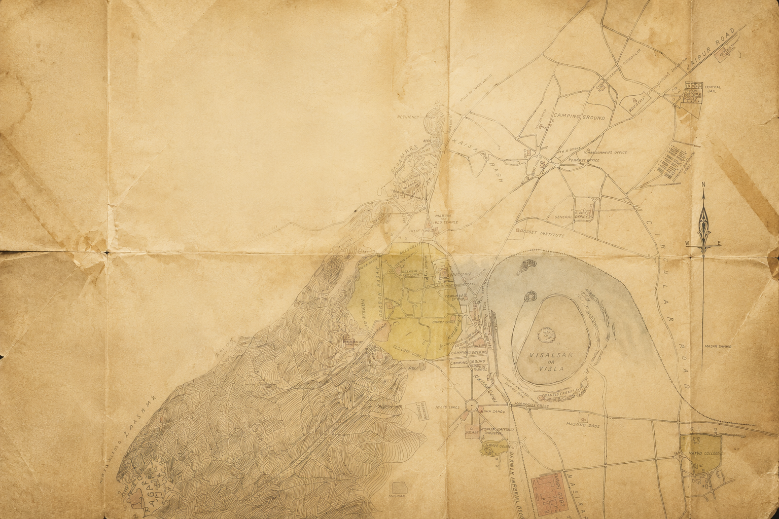
Reading a City Through Maps
The exhibition follows Ajmer across twelve moments in history, beginning in the early twelfth century when the Chahamana rulers established Ajayameru at the foot of Taragarh.
From there, visitors follow the city's transformation through successive political eras: the Delhi Sultanate, the Rajput kingdoms, the Mughal Empire, the Marathas, British administration, the brief existence of Ajmer State after Independence, and finally the contemporary city seen from space.
Rather than relying primarily on artefacts, the exhibition uses historical maps, paintings, administrative documents, demographic information, satellite imagery, and infographics to show how the valley changed over time.
The maps reveal that geography shaped nearly every stage of Ajmer's history. Water from the Saraswati and Sagarmati streams, the commanding height of Taragarh, and the gap through the Aravalli hills made this valley an ideal place to found a city. Those same geographical advantages later attracted traders, emperors, pilgrims, railway engineers, and colonial administrators.
As visitors move through the exhibition, they will be able to see patterns that are difficult to notice when looking at individual monuments in isolation - how political boundaries shift repeatedly, trade routes appear and disappear, new neighbourhoods emerge beside older ones, and centres of power move elsewhere, while places such as the Dargah of Khwaja Moinuddin Chishti remain constant across centuries of political change.
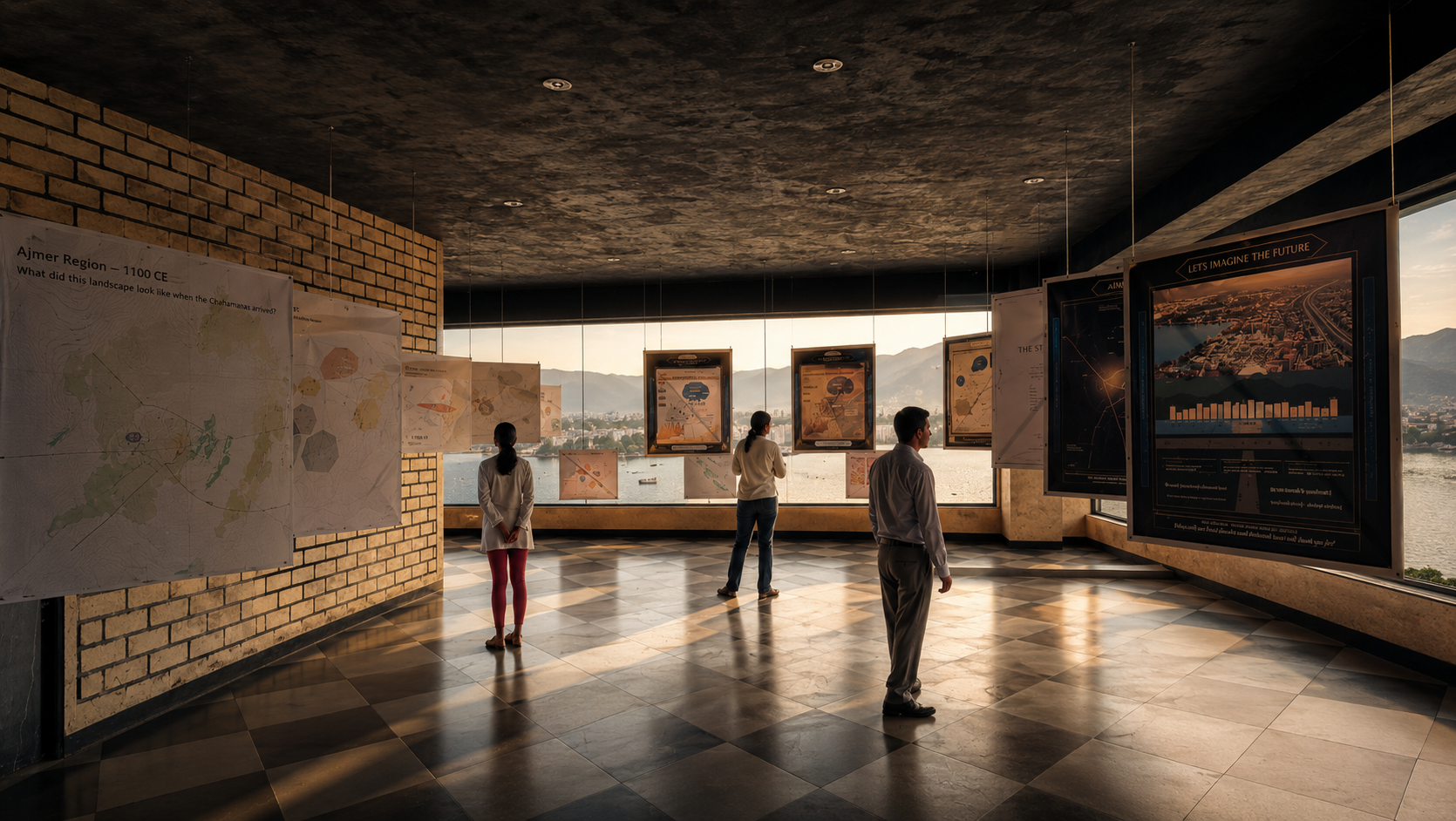
A Scenographic Experience
The exhibition itself has been designed as an immersive walk through time.
Rather than displaying objects in traditional museum cases, the maps and graphics are suspended from the ceiling, encouraging visitors to walk around and between them. Each panel represents a different historical moment, allowing the audience to experience the city's transformation as a sequence rather than a collection of disconnected events.
The setting plays an equally important role.
The exhibition occupies the recently vacated fourth floor of the Project Bhaskar office building. The open, unfurnished space creates an uncluttered gallery where the suspended displays become the primary visual focus.
Large windows frame panoramic views of Ana Sagar Lake and the surrounding Aravalli hills—the same landscape that appears throughout the historical maps. Visitors frequently find themselves comparing the centuries-old maps before them with the living landscape outside, collapsing the distance between past and present.
Looking Beyond Heritage
The exhibition deliberately avoids presenting history as nostalgia.
Instead, it asks visitors to think about urban change.
One of the recurring questions throughout the exhibition is why cities evolve differently. Ajmer was once an important Mughal administrative centre, later a major railway hub under British rule, and briefly the capital of Ajmer State after 1950. Yet today it occupies a very different position within India's urban hierarchy.
Rather than offering simple answers, the exhibition encourages visitors to consider the many forces that shape cities over long periods: geography, political decisions, trade networks, infrastructure, religious institutions, and public policy.
Understanding these changes is essential before exploring the city's social history, which will form the focus of future phases of the project.
Project Bhaskar's Approach
At Project Bhaskar, we believe history can become more accessible when it is presented visually.
Maps are not simply illustrations. They are tools for understanding how landscapes, communities, and institutions evolve across time. By combining archival research, historical cartography, GIS data, and contemporary design, 1000 Years of the Valley demonstrates how data visualisation can help people see familiar places in entirely new ways.
Ultimately, the exhibition invites every visitor to rediscover a city they thought they already knew.
1000 Years of the Valley
Venue: Project Bhaskar, Fourth Floor Gallery
Dates: 27 May – 5 July
Admission is free. Visitors are welcome during office hours.
Adaptiv Admin
@admin
Building the future of AI products at Adaptiv.Me.